| Port of Salem | |
|---|---|
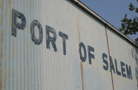 Port of Salem building sign | |
 Click on the map for a fullscreen view | |
| Location | |
| Country | |
| Location | Salem, New Jersey |
| Coordinates | 39°34′26″N 75°29′02″W / 39.574°N 75.484°W |
| Details | |
| Operated by | South Jersey Port Corporation |
| Draft depth | 16 feet[1] |
| Air draft | Overhead power line |
The Port of Salem is a shallow-draft (16 feet) port in the vicinity of the Salem River Cut-Off on the Salem River in Salem, New Jersey in the United States about 2 miles (3.2 km) east of the Delaware River and about 54 miles (87 km) from the Atlantic Ocean. It was re-designated a port of entry in 1984 and became a foreign trade zone (FTZ) in 1987. Transloading operations include the handling of a variety of bulk cargo, notably of construction aggregate, break bulk cargo, and containers for clothing, fishing apparel, agricultural produce, and other consumer goods, and has at times involved lighterage. It is operated under the auspices of the South Jersey Port Corporation. The port is envisioned as being a component of the supply chain for the development of windpower in the Atlantic Ocean off the coast of New Jersey.[2]
© MMXXIII Rich X Search. We shall prevail. All rights reserved. Rich X Search